
History of Treviso
The History of Treviso
From a village of the ancient Veneti to a city of water, walls and frescoes: the story of Treviso told in layers, so you can recognize each one as you walk.
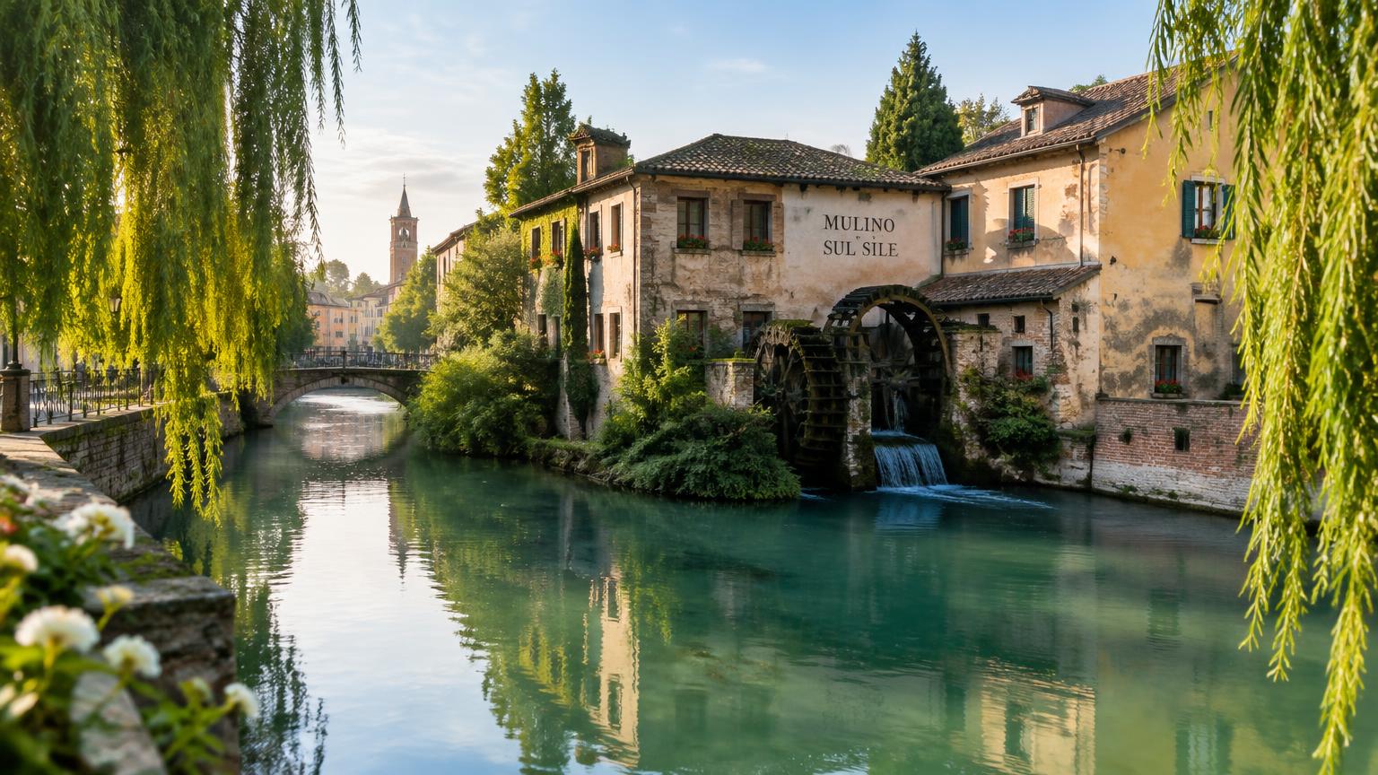
Treviso is a small city with a long biography. It stands in a place where water has always shaped events: the Sile river, the Botteniga and a network of canals running through the center powered mills, washed wool, kept markets moving and, in times of war, filled moats. Understand this relationship with water and you understand almost everything about the city.
It is also a painted city. For centuries, its façades were covered in frescoes, leading the writer to call it "urbs picta", the painted city. Many of these frescoes disappeared with time, rain and the bombings of 1944, but patches of color remain in arcades, courtyards and on interior walls, telling us what life here was like before photographs.
The itinerary below follows the course of time. Each chapter points out what you can still see today — so it is worth reading before you set out and again when you are standing in front of the place.
The city in six layers
II century BC — V century AD
Tarvisium: the Roman city
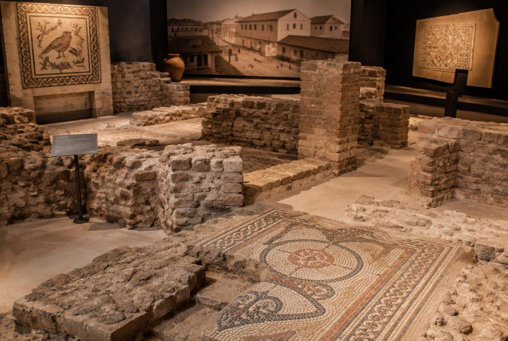
Before Rome, the region belonged to the ancient Veneti. With Roman expansion, the settlement became the municipality of Tarvisium, on the road to Oderzo and Aquileia, with orderly streets and a river port. During the crises of the V century, it was not abandoned: it remained a stronghold and later became the seat of a Lombard duchy.
Before Rome, the region was inhabited by the ancient Veneti, a people of horse breeders and traders connected to the Adriatic sea. As Rome expanded into northern Italy, the settlement became the municipality of Tarvisium — a name that scholars believe probably comes from a Celtic root (Tarvos) connected to the territory, rather than from a Roman founder — linked to the road leading to Oderzo and Aquileia, then one of the empire's great cities.
Roman Tarvisium was modest compared with Verona or Padua, but it had the essentials: an orderly street plan, a public center, houses and a river port. The ancient city occupied a kind of island formed by the meeting of the Cagnan, the Roggia and the Sile, and the intersection of its two main streets (the cardo and the decumanus) lay near what is now piazza Carducci — this is the origin of the almost straight layout still recognizable in streets such as Calmaggiore, Via Indipendenza and Via Santa Margherita, which follow the ancient cardo maximus.
The name Tarvisium has survived through the centuries and helps us understand the site's strategic position: close to important land routes, but also connected to the plain by water. The river was not scenery; it was transport, energy and defense. The earliest known mention of the city's name is an inscription from the I century AD, discovered only in the XIX century in present-day Croatia — a sign of how Tarvisium already belonged to networks reaching far beyond the Veneto.
During the crises of the V century — the end of Roman rule in northern Italy and the invasions sweeping through the region — the population of the plain sought more sheltered places. Treviso was not abandoned: it survived the Hunnic devastation, remained a stronghold under the Goths and later became the seat of a duchy under the Lombards and a county under the Carolingians, ensuring continuity between the ancient and medieval city.
What to see today: the almost straight layout of the streets in the center (especially the intersection near piazza Carducci), Roman finds in the Museo Civico Santa Caterina and sections of ancient wall reused in later buildings.
Places in this chapter
XI century — XIV century
The free commune and the frescoes
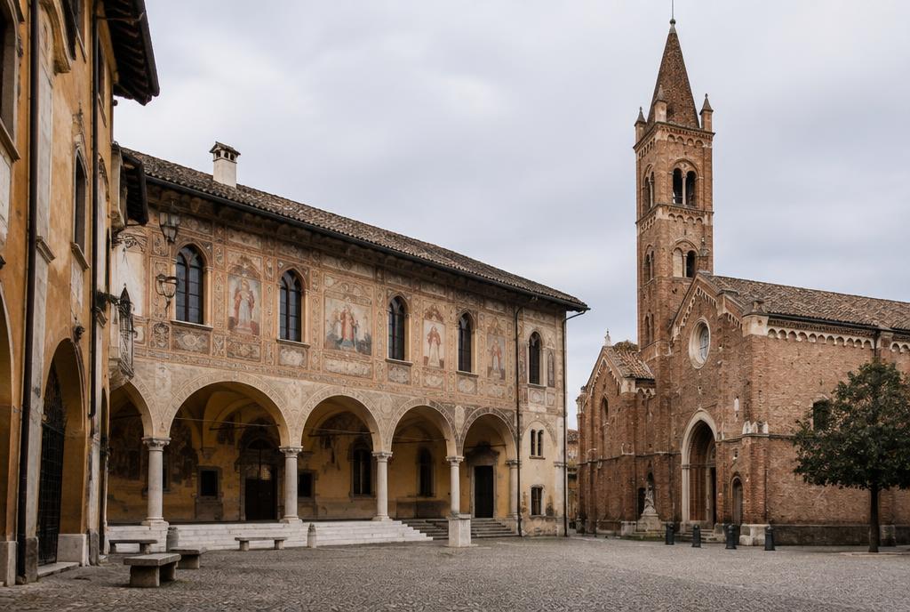
Between the XI and XIII centuries, Treviso governed itself as a commune, with statutes, councils and militias. Wool, leather, grain and wine enriched the city, the canals served as roads and arcades took shape around the markets. This was the age when façades were covered in frescoes.
Between the end of the XI century and the XIII century, Treviso organized itself as a commune: a citizens' government of its own, with statutes, councils and militias. In 1164, Emperor Frederico Barbarossa granted the city a series of privileges that strengthened this autonomy. This was when the great buildings that defined its urban identity appeared — the Palazzo dei Trecento (built from around 1213 on the site of an even older domus comunis), home to the council of three hundred citizens, the cathedral, the Dominican church of San Nicolò and the convent containing the famous room of friars' portraits.
The city grew wealthy through wool, leather, grain and wine. Water in the inner canals served as both a source of power and a roadway: barges reached almost as far as the squares. Around the markets, the continuous arcades took shape, still sheltering walkers from rain and sun today — around the Palazzo dei Trecento alone, there were once dozens of little shops rented out by the commune, with leases renewed every five years.
This was also the age of frescoed façades. Painting the outside of a house was a way to display status and send a message: coats of arms, religious scenes, geometric patterns. Treviso's mural painting influenced the entire region and culminated in works such as the frescoes by Tomaso da Modena in the chapter house of the former convent of San Nicolò (now the Seminário Vescovile): commissioned in 1351 by Prior Fallione da Vazzola and completed in 1352, as recorded in a Gothic inscription still visible beside the door, they show forty distinguished Dominicans in their study cells. One of them, Cardinal Ugo di Provenza, appears with a pair of simply framed spectacles resting on his nose — one of the earliest known depictions of glasses in Western painting — while in another cell, Cardinal Nicolau de Fréauville examines a book with a magnifying glass, another pioneering pictorial record.
The XIV century also brought the price of wealth: feuds between families, the rule of Gherardo da Camino and then his son Rizzardo, pressure from the Scaligeri of Verona (who controlled the city between 1329 and 1339) and the instability that pushed the city to seek a stronger protector.
Dante mentions the territory around Treviso in the Divine Comedy, and the court of the Da Camino, with poets and troubadours in its service, played a part in the political and cultural life of the medieval northeast. Reading the towers, churches and palaces as parts of this network reveals more than treating them as isolated monuments.
What to see today: Piazza dei Signori and the Palazzo dei Trecento (notice the exposed brickwork and its former role as courthouse and council seat), San Nicolò and the seminary chapter house with the fresco of 1352, the arcades of Calmaggiore and the façades with traces of frescoes.
1339 — 1797
Under the Lion of St Mark
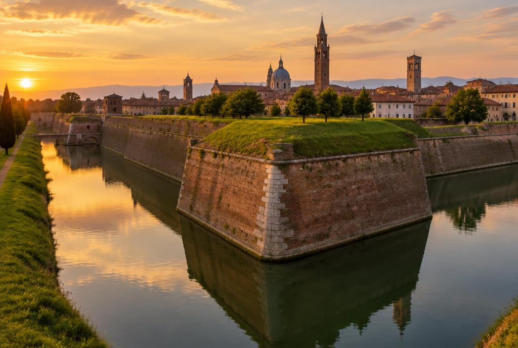
In 1339, Treviso came under the rule of Venice and spent more than four centuries under the Lion of St Mark. At the beginning of the XVI century, after the War of the League of Cambrai, Venice rebuilt the defenses: a ring of walls with bastions and a moat fed by the rivers, with three monumental gates.
On 11 February 1339, the peace signed with the Scaligeri of Verona formalized Treviso's entry under the rule of the Republic of Venice — the first mainland city incorporated by Venice, decades before the great Venetian mainland expansion of the XV century. The relationship lasted more than four centuries (with brief interruptions, such as the cession to Leopoldo da Austria in 1381 and Carraresi rule between 1384 and 1388) and shaped the city we see: Venetian administration, lions of St Mark carved on the gates, palaces with arched windows and an obsessive attention to water and defense.
At the beginning of the XVI century, after the War of the League of Cambrai (the coalition of European powers formed in 1508 against Venice), the Most Serene Republic entrusted the architect and friar from Verona, Fra Giocondo, with the complete rebuilding of Treviso's defenses. Between 1509 and 1520, a ring of walls took shape, with earthwork bastions faced in brick and detailed in Istrian stone, surrounded by a moat fed by the rivers — one of the most modern military works in Europe at the time. Porta Santi Quaranta was completed in 1517 and Porta San Tomaso in 1518; together with Porta Altinia, they are the three monumental entrances that still provide access to the center today.
The Venetian city was not just a fortress. It was an agricultural market, a bishop's seat, a place of villas and vegetable gardens. The surrounding fields supplied Venice, and the Sile carried produce to the lagoon. The rural landscape and local cuisine — including the patient cultivation of radicchio — grew out of this economy of market gardening, livestock and water.
In its palaces, gates and urban dimensions, the Venetian presence became part of everyday life. At the same time, Treviso kept a character of its own: a smaller scale, a direct relationship with the countryside and a network of squares where trade, government and social life mingled.
What to see today: the walk along the walls (Viale Bartolomeo d'Alviano), the moat with its flowing water, Porta San Tomaso — with the artillery casemates still visible underneath — and the stone lions on gates and palaces.
centuries of living together
The city of water: Cagnan, Sile and mills
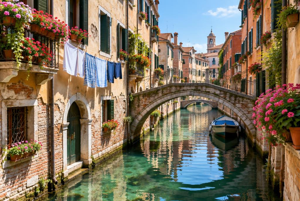
The Botteniga enters the city and divides into the cagnani, which cross the center and return to the Sile. This system powered mills, wool fulling mills and sawmills, and around it came washerwomen, fish shops and markets. Today, it has become a landscape of paths, restored mills and herons in the center.
The Botteniga enters the city and divides into several branches — the cagnani — which cross the center and rejoin the Sile. This system was built and adjusted over generations, with sluice gates, retaining walls and strict rules about who could divert water and for what purpose: medieval communal statutes already regulated mills and the use of water as a public resource.
The canals powered grain mills, wool fulling mills, sawmills and, later, small factories. Along them came washerwomen, fish shops and markets: the Pescheria, still set on a small artificial island in the water today, existed precisely because the river carried away the fish scraps.
Water also explains the city's most curious monuments. The Fontana delle Tette, carved from Istrian stone in 1559 on the orders of the podestà Alvise Da Ponte after a severe drought, stood in the courtyard of the old praetorian palace in Calmaggiore: whenever a new podestà took office, until the fall of Venice in 1797, it flowed with red wine from one breast and white from the other for three days, free for anyone who wanted a drink. The original sculpture, damaged by Napoleonic troops, is now kept in a display case beneath the portico of the Palazzo dei Trecento; a copy from 1989 stands in the courtyard of Palazzo Zignoli, near a plaque bearing the account of the fountain by Treviso physician Matteo Sernagiotto.
Today, that same system has become a landscape: waterside paths, restored mills, herons and ducks right in the center, and the Sile park, which connects the city to the countryside without leaving the riverbank.
Notice, too, the changes in level, the mill wheels and the little passages beneath buildings. They reveal a historic infrastructure that can still be read: water was channeled to work, circulate and protect before it became one of Treviso's most photographed sights.
What to see today: the Pescheria, the Fontana delle Tette (the original beneath the portico of the Palazzo dei Trecento, the copy in the courtyard of Palazzo Zignoli), Riviera Garibaldi, the mills of the Sile and the walking or cycling route along the river.
1797 — 1945
Napoleon, Austria, Italy and the war
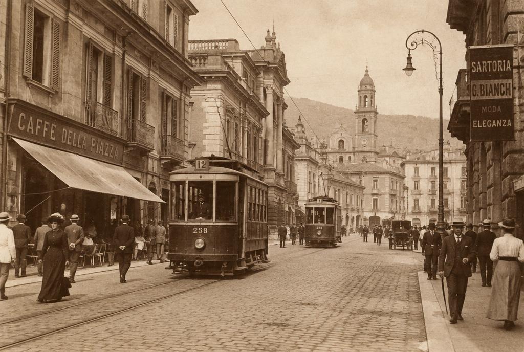
With the fall of Venice in 1797 came the French and Austrians; in 1866, the Veneto joined the Kingdom of Italy. Trains, the textile industry and trams followed. The First World War placed the city close to the Piave, and the Second was even harsher, with the bombing that destroyed much of the center.
With the fall of the Republic of Venice in 1797 came the French, followed by the Austrians. The city lost military importance and gained wider streets, schools, a theater, barracks and a middle class of merchants and professionals. In 1866, after a plebiscite, the Veneto joined the Kingdom of Italy.
The beginning of the XX century brought trains, the textile industry, electricity and trams. Treviso became the agricultural and commercial center of a prosperous province, and trade in fabrics, wine and local produce financed fine townhouses and cafés around the squares.
The First World War placed the city close to the Piave line: air raids, military hospitals and thousands of refugees. The Second World War was even harsher. On 7 April 1944, Good Friday, 159 American B-17 bombers dropped around two thousand bombs on the city in just a few minutes: estimates of civilian deaths range from just over a thousand to around 1.600, including many children, and around 80% of the center's built heritage was destroyed or damaged, including parts of the Palazzo dei Trecento, the cathedral, the baptistery and the old church of San Martino. To this day, the city marks the date with a tolling bell in the Torre Civica at the same time as the attack.
Postwar reconstruction chose a path of restoration rather than erasure. Bricks and stones were recovered whenever possible, the Palazzo dei Trecento returned to the heart of public life and, on its façade, a line of slightly recessed bricks still marks, for those who know where to look, where the original masonry ends and the rebuilt section begins — even the battlements were remade in the Guelph style, different from the prewar Guelph/Ghibelline version.
The memory of the 1944 attack is not confined to plaques: it explains empty spaces, reconstructed façades and the local awareness that heritage can disappear quickly. Visiting Treviso also means acknowledging this trauma without reducing the whole city to it.
What to see today: the line of recessed bricks marking the reconstruction of the Palazzo dei Trecento, the memorial to civilian victims at the foot of its staircase, the plaques commemorating the bombing of 1944 in Piazza dei Signori and the municipal theater.
1950 — today
Contemporary Treviso
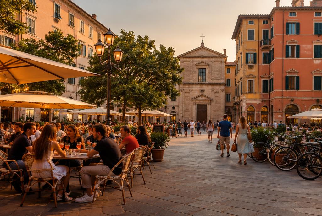
After the war, the province became one of the industrial powerhouses of northeastern Italy: furniture, shoes, fashion, bicycles, wine. The center, protected by the walls, remained compact and walkable, and in recent years water has once again become the focus of urban planning.
In the following decades, the province became one of the industrial powerhouses of northeastern Italy: furniture, household appliances, shoes, fashion, bicycles, wine. World-famous brands were born here, and the surrounding countryside came to combine vineyards, workshops and small factories.
The historic center, protected by its walls, remained compact and walkable. Life unfolds around the squares at aperitivo time, the street markets, the arcades and the canals. The city also became a peaceful base for visitors to Venice, the Prosecco hills and the Dolomites.
In recent years, water has once again become the focus of urban planning: cycle paths along the Sile, restored mills, attention to the springs and a kind of tourism more interested in strolling slowly than rushing between monuments. It is this Treviso, both a painted city and a city of water, that this guide tries to explain.
Life today is still tied to old habits: stepping under an arcade when it rains, finding the market in the morning, pausing beside a canal and following the walls around. The past is not separate from daily life; it determines the scale and rhythm at which the city is lived.
What to see today: the squares in the late afternoon, the market, the Sile cycle paths and the neighborhoods outside the walls.
Places in this chapter
XX century — today
Flavors born of this land
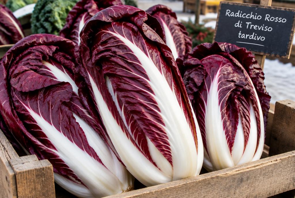
Radicchio, prosecco and tiramisù are not souvenirs: they grew out of the same water, the same cold and the same market-gardening economy that shaped the city. Late-harvest radicchio depends on the springs of the Sile, prosecco on the hills to the north and tiramisù on the urban kitchens of the XX century.
Radicchio rosso di Treviso is the city's culinary symbol and comes in two versions: the early-harvest variety, resembling an elongated lettuce, and the late-harvest variety, with dark red leaves and crisp white ribs. The late-harvest variety undergoes an unusual process: after the frost, the plants are placed in tanks of spring water kept at around twelve degrees, where they sprout again in the dark.
Prosecco comes from the glera grape, grown in the hills north of the city, between Conegliano and Valdobbiadene, and on the surrounding plains. It is a wine made with a second fermentation in tanks, with fine bubbles and aromas of green apple, pear and white flowers. In Treviso, it is not a drink reserved for special celebrations: it is the chilled glass at the end of the day, with something savory to eat with your fingers.
Tiramisù has just a few elements: egg yolks beaten with sugar, mascarpone, savoiardi biscuits soaked in coffee and cocoa powder on top. The city considers itself the birthplace of the dessert, created here in the second half of the XX century, and there is even a world championship dedicated to it in the region.
What to see today: the street markets in winter, when late-harvest radicchio appears, and aperitivo time in the squares.
Worth remembering
- Roman name
- Tarvisium, a municipality linked to the road to Aquileia
- Entry under the rule of Venice
- 11 February 1339, the first mainland city
- Present-day walls
- 1509–1520, designed by Fra Giocondo, with a moat fed by the rivers
- Nickname
- urbs picta, the city painted with frescoes
- Frescoes by Tomaso da Modena
- 1352, chapter house of San Nicolò, with the famous friar wearing glasses
- Fontana delle Tette
- carved in 1559 on the orders of the podestà Alvise Da Ponte
- Most painful date
- 7 April 1944, bombing that affected around 80% of the center's built heritage
- Rivers
- Sile, Botteniga and the cagnani canals within the center
A walk through history
A route of around two hours that takes you through the layers in the order you have read them.
Porta San Tomaso
Monumental Venetian entrance, with the lion of St Mark and the moat alongside.
See on the mapWalls and moat
A stretch of walking along the XVI-century embankment.
See on the mapCathedral and baptistery
The medieval layer and later reconstructions, with crypts.
See on the mapCalmaggiore
The arcaded street linking the cathedral to the squares; traces of painted façades.
See on the mapPiazza dei Signori and Palazzo dei Trecento
The heart of the free commune and the visible mark of postwar reconstruction.
See on the mapFontana delle Tette
A quiet courtyard beside the squares; the fountain that flowed with wine.
See on the mapPescheria
The fish-market island in the middle of the canal.
See on the mapSan Nicolò and chapter house
Gothic frescoes and the portrait of a friar wearing glasses, from 1352.
See on the mapRiviera Garibaldi and the mills of the Sile
Finish on the riverbanks, where the city's history begins and continues.
See on the map
About this information
An introductory text based on current historical literature about Treviso and the Veneto and on public information from museums and the municipality. Monument dates, opening hours and access arrangements may change: always check official channels before visiting.